AR
ARExplore the Museum / Astronomy and Navigation

9:00 a.m. – 4:00 p.m | Sunday to Thursday
9:00 a.m. – 4:00 p.m | Sunday to Thursday
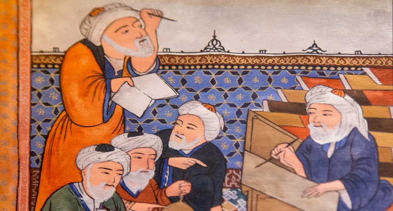
The many contributions made by Muslim scholars to astronomy and navigation are reviewed in this cluster. Also, highlighted are the practical uses of astronomy – to determine the dates of the holy months, the time of prayer and the direction of the “qibla”.
This interactive world map allows you to compare the routes traveled by the famous Muslim traveler, Ibn Battuta, with those of other famous travelers.

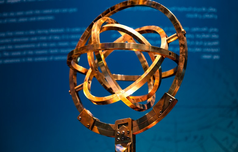
A tabletop Armillary Sphere is a basic model of the solar system. Large Armillary Spheres were used for observation.
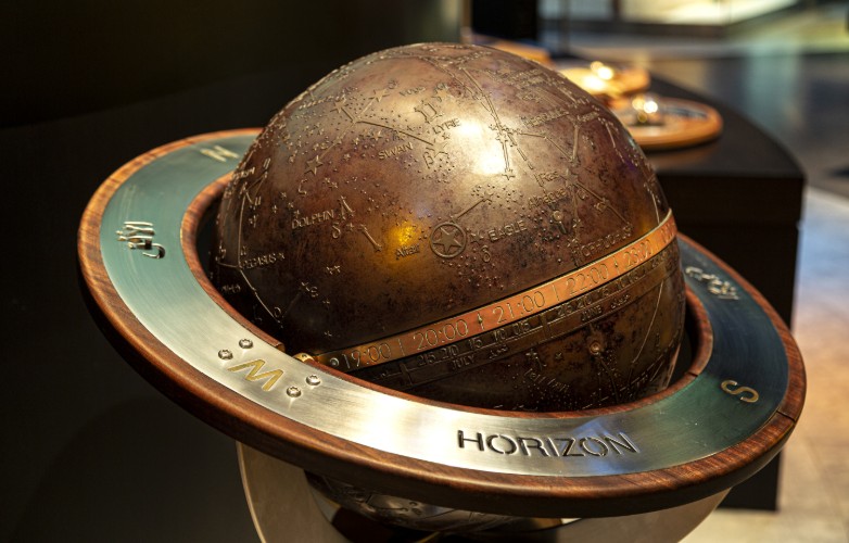
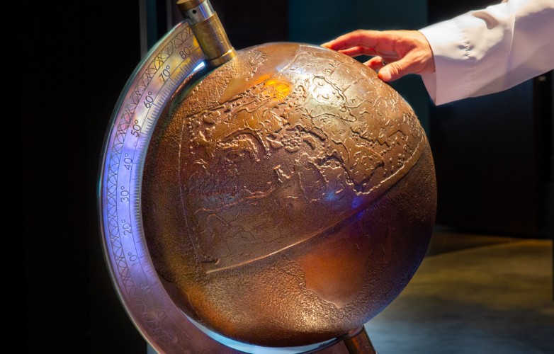
Celestial globes recorded the distribution of celestial bodies (planets, moons, stars) in the night sky.
This video reviews the journeys made by four great Muslim travelers, navigators and cartographers, including Ibn Battuta, Ibn Majid, Piri Re’is and Zheng He.
This six-minute video provides an overview of the significant contributions made by Islamic scholars to astronomy and navigation.
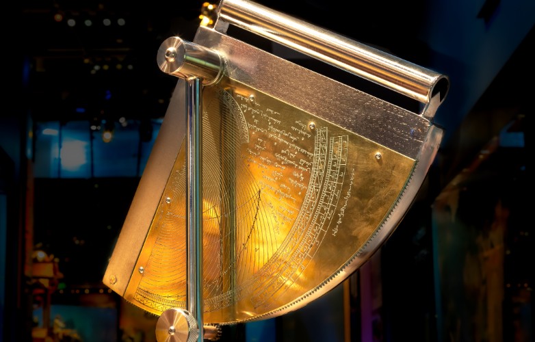
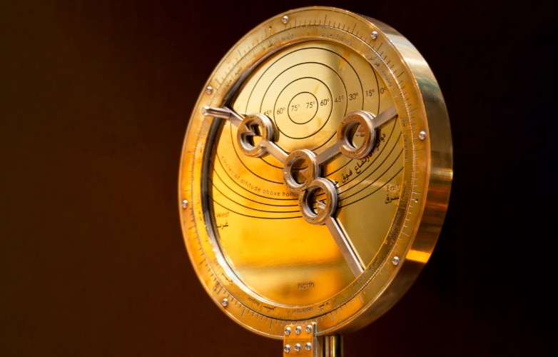
The Quadrant was one of the most important astronomical and navigational instruments used by early Muslim scholars. It is used to determine the height of a celestial body above the horizon.
The flat map of the known world produced by al-Idrisi in 1154 is shown here on a spherical globe. The outlines of the continents that we know today are also shown on the globe.
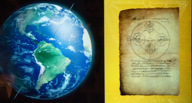
The remarkably accurate calculations made by Muslim astronomers and navigators of the circumference, radius and diameter of the Earth, as well as their discoveries in relation to the phases of the moon and the way in which the Earth revolves around its axis, are shown in this display. Some of the features on the Earth’s moon that are named after Muslim scholars are also on display
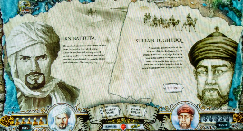
When Ibn Battuta set out from his home in Tangiers in 1325 at the age of 21 years on his hajj to Makkah, he did not realize that he would spend 29 years on the road. During his epic journey, Ibn Battuta met 60 Heads of State and visited over 40 modern-day countries on his extended pilgrimage.
During his extensive travels he visited nearly every part of the Islamic world, from Andalusia in the west, West and East Africa in the south, the Gulf region and Asia Minor in the north, to India and China in the east.
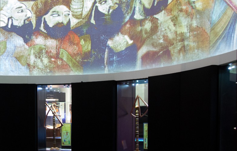
In the niches along one wall of the ‘Astronomy and Navigation’ theater, exact scale model replicas of famous astronomical and navigational tools made by Muslim scholars are displayed.
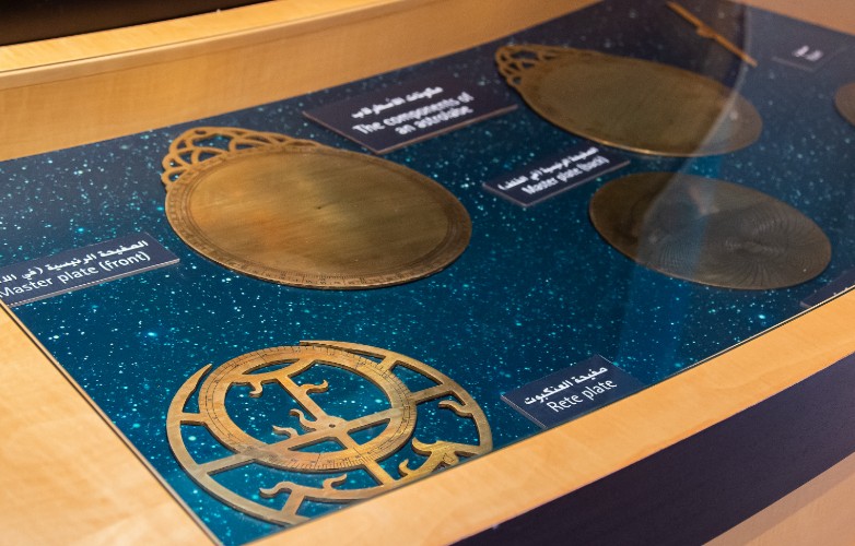
The different components of an Astrolabe are displayed in the drawer.
The Astrolabe was the equivalent of a medieval calculator. They were used for a wide variety of observations and calculations in astronomy and navigation.
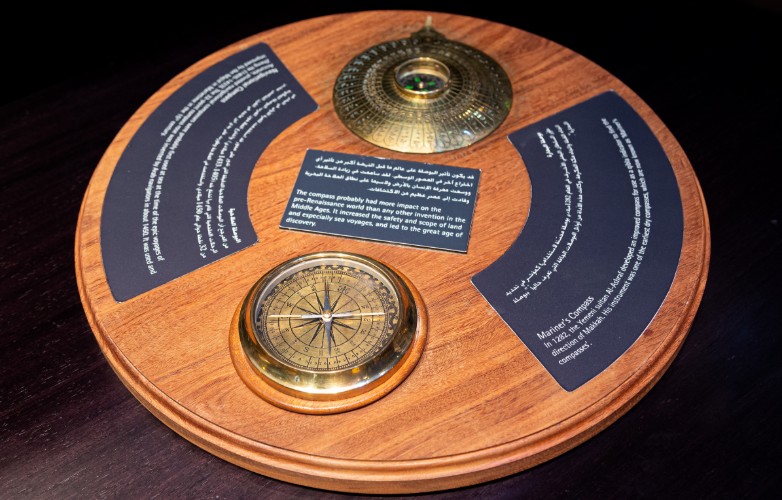
Four stages in the development of the magnetic compass are displayed.
The Astrolabe was the equivalent of a medieval calculator. They were used for a wide variety of observations and calculations in astronomy and navigation.
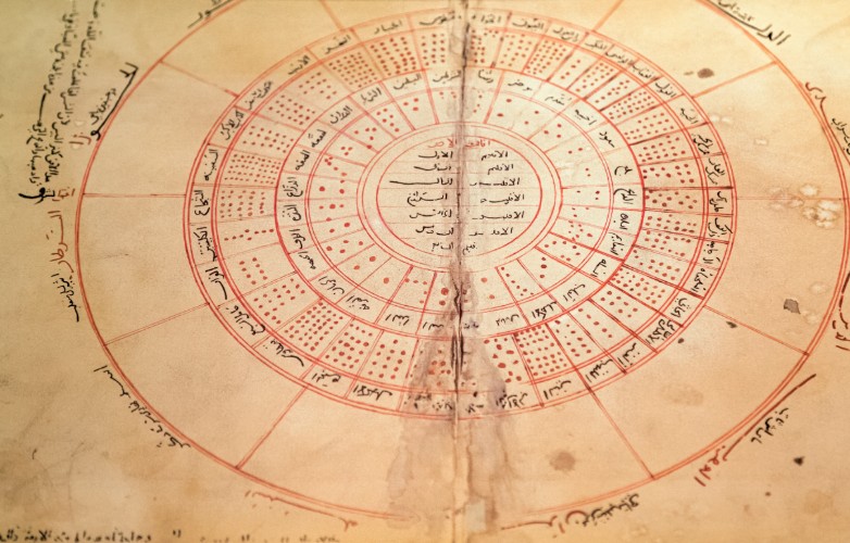
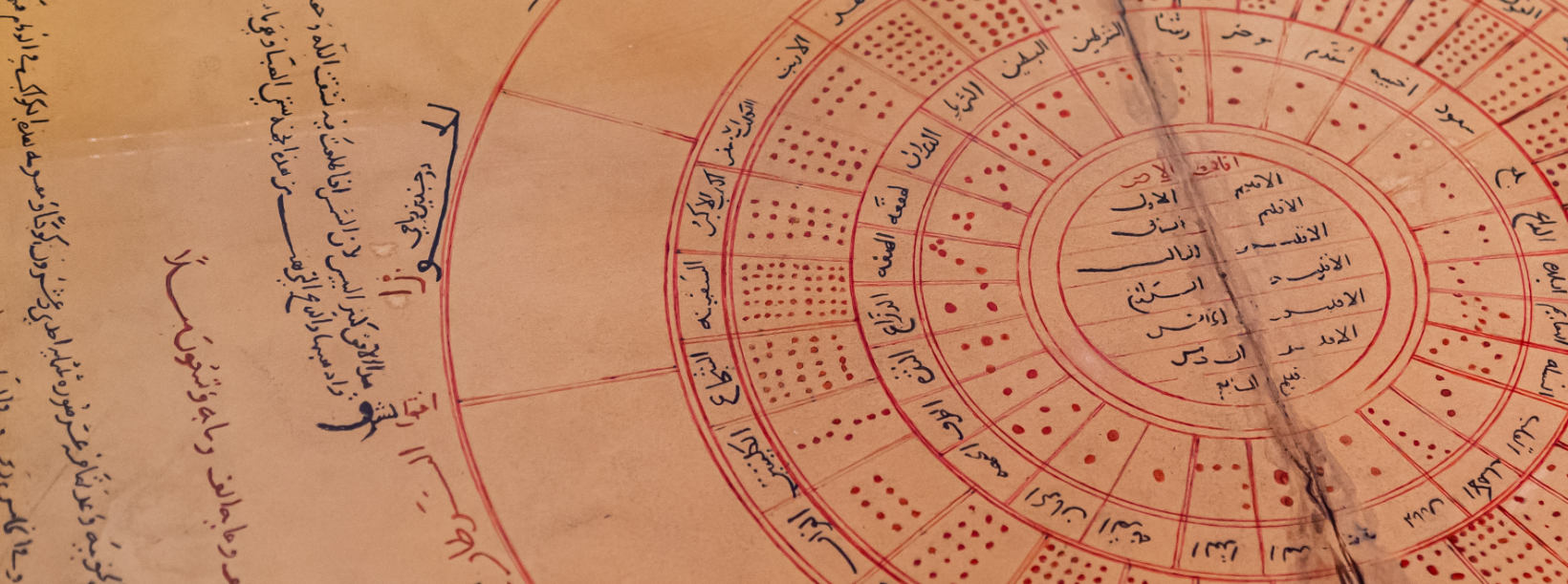
This drawer displays an early Islamic diagram of the universe.
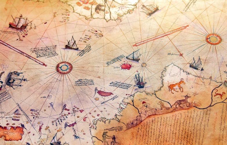
A replica of Piri Re’is famous map, the first to show the Antarctic Peninsula and the east coasts of South and North America, is displayed.
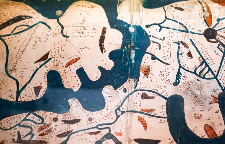
This drawer displays a 11th century map from the ‘Book of Curiosities’.
Due to limited capacity, admission to the Museum is limited to community & the University's invited guests.
The Museum is located in the Museum and Conference Building (Building 19), on level 1.
© 2020 All rights reserved, Museum of Science and Technology in Islam - www.kaust.edu.sa
Developed by: Brackets Technology